A personable, magenta-haired barista at the Waimea Coffee Company made an açaí bowl and blue smoothie for us shortly after checking out of our motel. Açaí bowls were invented in Brazil, but they came into America through Hawai’i. Despite my love of food and the presence of açaí bowls in U.S. cuisine for over a decade, I had managed never to try one. The bowl was really good and really cold. For others who have never tried this dish, an açaí bowl is a fruit smoothie crowned with various healthy toppings like the traditional combination of granola, bananas, peanut butter, blueberries, and a drizzle of honey.
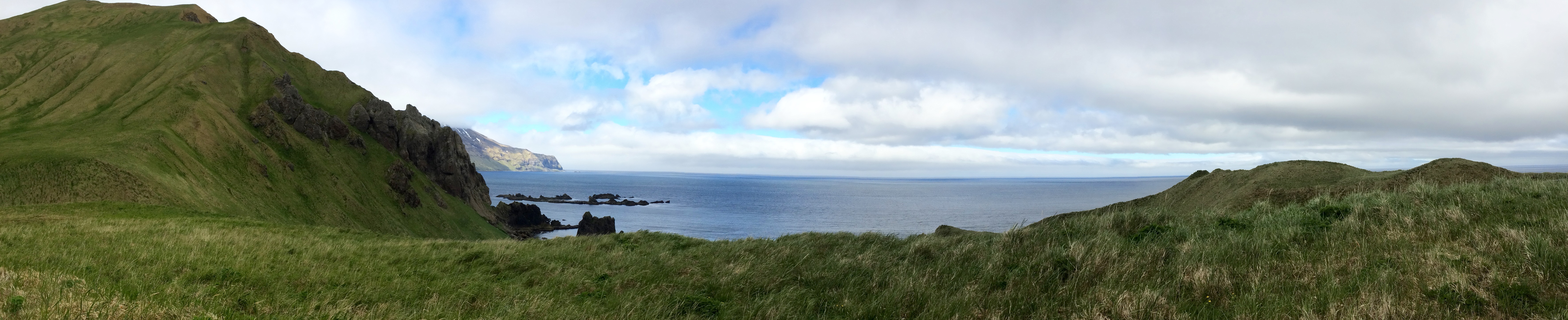
Along the island’s east coast, we stopped at Laupahoehoe Point and watched the sea crash to shore in white spray against jumbles of jagged black rocks. Whoever named the Pacific didn’t do it in this particular spot. Much of the Big Island of Hawai’i’s coastline, in fact, is anything but peaceful. There is a memorial at Laupahoehoe Point for 25 people who were lost in the 1946 tsunami. Three people survived the event there, all dragged out to sea on debris and later rescued. Near the memorial were some kukui (candlenut trees, Aleurites moluccanus), a fascinating tree with husk-covered, fat-laden fruits that look like pear-shaped macadamia nuts when shelled. The candlenut was named the Hawai’i State Tree in 1959 despite being imported from Polynesia, and the nuts are reportedly toxic raw but edible when cooked.

Waves crashing ashore 
Laupahoehoe Point 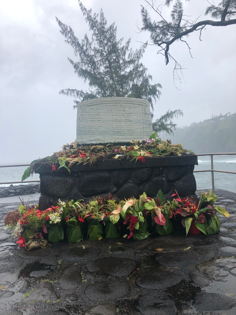
Memorial to tsunami victims
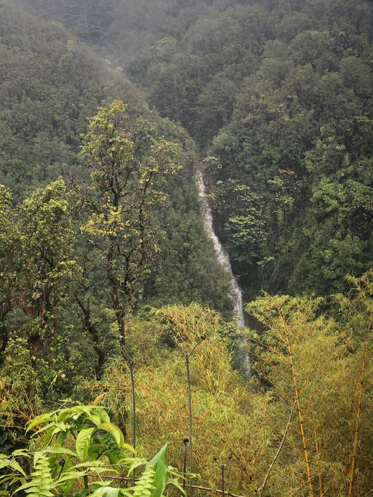
Further down the coast is ‘Akaka Falls State Park. A driving, soaking rain confronted us when we arrived, so we went back down the road to Hilo Shark’s Coffee in Honomu and enjoyed cups of rich coffee made from beans grown and roasted there on the mountain. After visiting Glass from the Past, an interesting little antique shop next door that specialized in vintage bottles, the rain had let up enough that we tried to hike the falls again. The whole park was so beautiful! There were stands of golden bamboo, an incredibly huge, old banyan tree with notches carved in one of the myriad trunks for climbing, and other plants so dense and healthy that it seemed we were in a botanic garden, but this garden had fresh, cool air and no glass walls. First we got a sidelong glance at Kahuna Falls (kahuna means priest in Hawaiian), which were running strong from the rain, then the trail looped around to the main ‘Akaka falls. The falls were swollen from rain, and several other thin but tall falls ran nearby. Three more waterfalls were waiting for us to admire from the trail on the way back to the car. Even though the trail can be crowded, and there is an entrance fee, which was on the honor system when we visited, this trail was more than worth the stop. It’s also more than worth the entrance fee, which we did not hesitate to pay because the revenue helps support the park.
Kahuna Falls 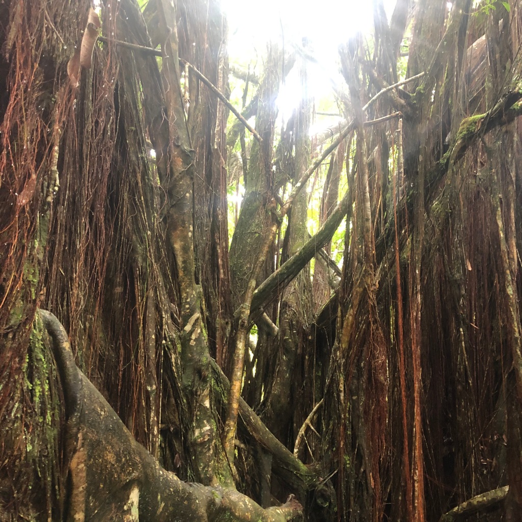
Sunlight through a banyan tree 
‘Akaka Falls
Later in Hilo, we were hankering for a burger, so we stopped at the “Hilo Burger Joint.” It was somewhat busy, even after 2 p.m. We found the food to be good but not great, but unfortunately the service was terrible. It was our server’s first day on the job. We’re usually very forgiving of this, but the poor lady had obviously not been trained, and nobody was helping her. Our order was wrong, and after we received our food, we were totally on our own. Joseph could have used another cup of coffee, for instance, but nobody came by, and it was hard to find anyone. We waited a really long time for our check before we had to get up and ask for it. On the upside, I was able to try a Hilo Breakwall IPA, which was really good. A lot of talented brewmasters live in Hawai’i, especially on the Big Island.
We rented a cabin at Volcano National Park that would be better for locals, who can bring supplies, than for visitors like us, who have been limited to airline baggage. There was only one electrical outlet, no heat, and access to a single bathroom for the whole campground. Linens were provided as advertised, which fortunately included two big comforters that kept us pretty warm but captured a lot of damp condensation by morning. There were no good hiking trails near the cabin, so I followed a game trail for a while into the ohi’a forest on the outside slope of Kilauea. A series of rock hills sounded hollow like drums when I stepped on them. They were actually underground lava tubes! After about half an hour, I turned around and promptly got lost trying to retrace my steps. Not too lost, really, because I could hear the road in the distance, and I had GPS on my phone, but it was a bushwhack back to the cabin. On the way I saw two kalij pheasant hens, one with a chick, and some gorgeous bamboo orchids (Arundina graminifolia).
After dark, we drove to the crater rim and hiked to an overlook to experience the red glow of liquid lava. Earlier in the week, visitors were allowed to the parking lot below the Jaggar Museum, which now sits a lot closer to the Halema’uma’u Crater than it used to. The museum is part of the Hawaii Volcano Observatory. The museum building was damaged and closed during the 2018 eruption and may never reopen. The Jaggar Museum isn’t the only casualty of Kilauea’s recent eruptions. There was once a road that circled the caldera rim. Aerial views show how sections of this road were obliterated as the caldera’s rim began to shift. Pieces of road can be seen still intact below the rim. Tonight, we were only allowed to go as far as the Kilauea Overlook, one parking lot down from the Jagger Museum, but we could see the red glowing gases well as they rose in the light rain, a sight not soon forgotten. We would find out later that an old friend, Lani Lisa, had come to this same caldera rim during the 2018 eruption. This is where she began to embrace her birth name, Lani, which had previously been only a leading initial L. Even a sideways glance into the goddess, Pele’s, home has the power to change a human life.
Bamboo orchid growing wild 
Kalij pheasant chick and hen 
Kilauea’s glow is hard for me to capture with a lens
The cabins were a ten minute drive from Volcano House, the only place still open where we could get some warm food and hot drinks. The drinks consisted of weak Swiss Miss hot cocoa mix, but the food was pretty good, especially the hot tomato bisque. Everything was terrifically overpriced, as National Park Service vendors tend to be. COVID precautions meant that dinner was served in styrofoam containers in stapled paper bags, which servers delivered to the front counter for us to pick up. Dining at Volcano House in happier, pre-pandemic days may have been more charming, but styrofoam tends to siphon off a lot of charm for me.
Back at the cabin, I walked to the nearby campground. It was closed to campers during the pandemic but open to walkers. I wasn’t sleepy and wanted to catch a glimpse of stars. Even from the campground, Kilauea’s red glow stretched across a slice of the sky. Later in the night, I would wake up from my dreams, imagining the volcano’s enormous magma chamber churning deep below. Pele’s bodily form is understood to be the volcano itself – the lava, the vents, the fumes. All of it is Pele. Magnified by the darkness, the goddess was even more disconcerting from our tiny cabin, perched on her back.


 st of the northern part of the island, and the


 for sure: despite political promises, it won’t be filled with millions of coal and petroleum industry and internal-combustion-engine-automobile-manufacturing jobs. It also won’t host teams of men who cut down old-growth forests or slaughter vast herds of wild bison for their tongues and tenderloins. These resources are on their way out, or they are already long depleted, reduced to island populations across our continent. Only so many ancient organisms were long ago turned into coal and oil beds. Their number was vast, but now they’re depleted, too. Like the bison. Like the old-growth trees. It’s a simple fact, no matter how many curtains you draw or cups of instant coffee you brew. Whether you “believe in” global climate change or not, the coal and steel industries are not coming back. We need to choose something else.