The Abandoned North: Part VI – Arctic Seas

Kanaga
Kanaga Island from the Tiglax

My time on Adak Island comes to an end with the arrival of the Motor Vessel (M/V) Tiglax (also known as the Research Vessel [R/V] Tiglax). The Tiglax (pronounced Tec-lah, meaning “eagle” in Unangam Tunuu) is a boat used for U.S. Fish and Wildlife Service scientific research. It serves the Alaska Maritime National Wildlife Refuge, which contains many of the Aleutian Islands. This summer, as in the past, Fish and Wildlife has kindly provided passage to Department of Energy contractors for our Amchitka Island scientific monitoring.

Tiglax
The Tiglax from the dock in Constantine Harbor, Amchitka Island

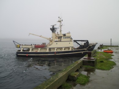
The 120-foot Tiglax was built in 1987 for Fish and Wildlife and has been working hard ever since. The captain, Billy Pepper, and five other crew members work hard as well. In fact, I can’t recall a time aboard the boat when I don’t see the cook at work. She conjures up handmade dishes like pesto-and-blue-cheese-stuffed pork roast, seafood linguine, and  blueberry pastries, all on a tight government budget, in a tiny galley, and with very little waste. I am an avid home cook and foodie, and I am impressed by her efforts in this remote place to keep both crew and passengers happy and well fed.

Flotation suits
Craig Goodnight and me in flotation suits during the muster drill

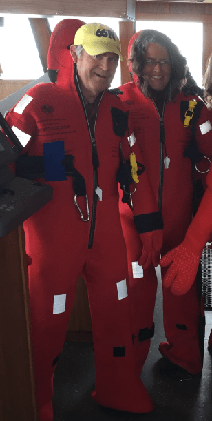
Anyone who has taken a cruise aboard a ship will be familiar with the muster drill. Similar to the health and safety briefing given before all of the government contract work I have ever done, it familiarizes the passengers with the boat’s emergency procedures. In this case, it consists of what to do if there is trouble on the  Tiglax and we have to abandon ship. The vessel is well maintained, and the crew is highly experienced, but I can’t help but think, as I try on an insulated survival suit that will keep me alive and afloat should the unthinkable happen, “This is the friggin’ Bering Sea!”

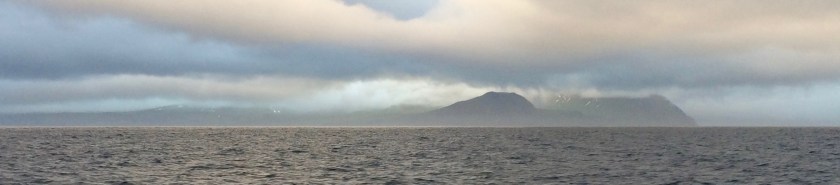
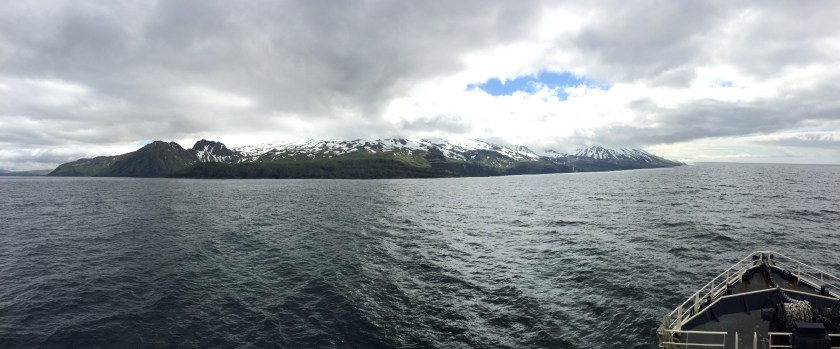
The weather is beautiful, and the sea is calm as we depart for Amchitka Island. The Tiglax will be our home during the voyage and also while we are working on the island. We share the boat with several other teams who also have work there. One is from Fish and Wildlife, who have work characterizing one of the few old structures standing on the island.

Dani on Tiglax
Danika Marshall on top of the Tiglax

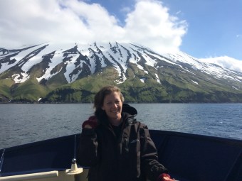
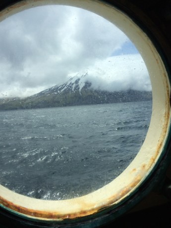
The other is from the U.S. Geological Survey, who need to do maintenance on seismic monitoring equipment. Our voyage will take about a day. I spend most of the daylight hours outside, drinking in spectacular views from a perch with some of the other passengers on the top of the boat. Much of the night is spent crossing Amchitka Pass, a patch of open ocean where the waves grow large. I am jolted around in my bunk but manage to get a decent night’s sleep anyway. The first mate, John Faris, has spent the night at the helm, as he does every night during the field season. My experience on the Tiglax gives me even more respect for people who make their living on the Bering Sea. I’m not sure it’s a life I could thrive on.

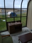
Left: The corridor outside State Room No. 4 on the Tiglax. Right: I choose the top bunk

Porthole
The view from the port hole by my bunk as we voyage to Amchitka Island

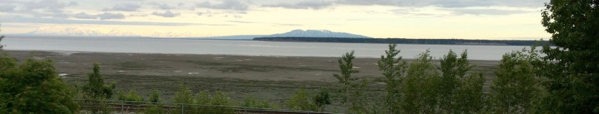
A peek outside the still vessel before coffee and breakfast reveals glassy waters and a massive, old military dock in Constantine Harbor, Amchitka Island. We have arrived safe and sound. I am ready and anxious to get to work. Now I just need to know how we’re going to get ashore. The smaller docks are in shambles, and the shoreline doesn’t look gentle with its dark volcanic rocks. The tide is out, and that ancient dock is towering above the top deck of the boat. Soon, we will find out.

Dock in morning

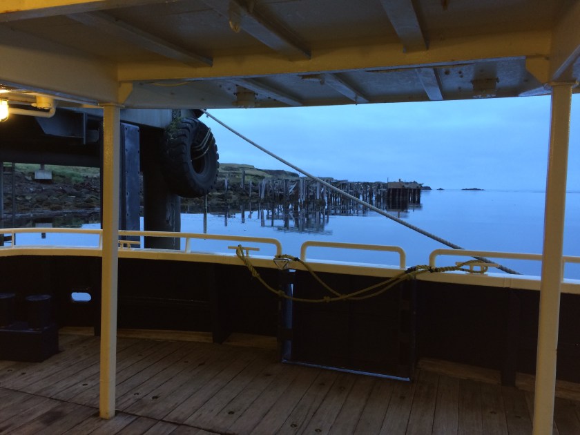
Early morning in Constantine Harbor

The Abandoned North, Part IV – Adak Island: Unexploded Ordnance


img_1340
Craig Goodnight at the top of a porphyry dome, Adak

Unexploded ordnance: these are two words I encounter often during my visit to the Aleutians. Called UXO for short, it comes in many forms – bombs, artillery shells, bullets, torpedoes. In the Aleutian Islands, it also comes from many

img_1484-1
A warning poster aimed at children to avoid UXO, featuring Boomer the Otter

places – ordnance left by the United States during World War II to defend against Japanese attacks, ordnance left by the Japanese to defend against U.S. attacks, ordnance used for weapons testing during the Cold War, ordnance launched but unexploded, and ordnance intentionally buried, or maybe even stored and forgotten. Large tracts of land on the northern  part of Adak Island are still being cleared of UXO, and we’re told that it’s possible to find it in unexpected places outside of this area. Warnings are everywhere, most prominently warnings for children. UXO even has its own mascot, a helmet-wearing Boomer  the Otter.

img_1366
Warning signs along the perimeter of an area where UXO is still being cleaned up

Unexploded ordnance is not the only danger to people of Adak Island. There are also a lot of abandoned buildings with hazards like disintegrating materials and broken glass. Some date back as far as 1942, when the U.S. Army first arrived. At the peak of the World War II Aleutian military campaigns, Adak Island was home to 30,000 people. There were probably between 6,000 and 7,000 residents living here later, during the Cold War, maybe more. According to the 2010 U.S. census, it is now home to 326 people, although the year-round population is said to be closer to 100.

Humanity’s ruined structures hold a particular fascination for me, as they do for many others, and, like skeletons, they only become more fascinating as they age. Don’t ancient Egyptian tombs hold more intrigue than homicide scenes? For this reason, I find the older quonset huts more compelling than the newer barracks, the older Bering Chapel more beautiful than its newer replacement.

Two World War II era quonset huts built in the 1940s. According to a historical guide published by the City of Adak,  the structure on the right was part of an early hospital facility.

Left: The historic Bering Chapel, built in 1944 by the U.S. Army Corps of Engineers, with newer windowless, abandoned dormitories in the background. Right: The now abandoned Bering Hill Chapel that replaced the older structure in the 1980s.

Left: View of an abandoned neighborhood in Adak. Some of the condominiums are missing walls, probably from Arctic hurricanes. Center: More abandoned condominiums, with snow-capped mountains emerging from the clouds. Right: A derelict vacuum cleaner, complete with its cord, outside one of the empty military facilities on the island.

img_1485
Unexploded ordnance is on the menu at Bay 5

As I expected, my favorite thing about Adak Island turns out to be the natural world, but before I get to that (in Part V), there is one more piece of UXO to mention: the Unexploded Ordnance at Bay 5. A fellow named Bernardo Diaz is the proprietor of Bay 5, Adak’s Mexican American restaurant. The establishment offers a unique dessert that consists of a deep-fried Snicker’s bar topped with cinnamon-sugar, chocolate, and whipped topping. It’s tempting, but I decide not to buy one, as I am already full from delicious chicken enchiladas swimming in unpredictably fresh and authentic red chile. Surprises from remote Alaska never cease.

The Abandoned North, Part III – Adak Island: Birthplace of the Winds

img_1347
Horseshoe Cove on Adak Island

When I was in high school in Denver, Colorado in the late 1970s, we were all trained to fear the Soviet Union and to worry about potential nuclear warfare. At that time, I’d never heard of Adak Island, although it was an important military base. Activities on the Adak Naval Air Station were not advertised during the Cold War. It wasn’t easy for civilians to visit, and other facilities such as Shemya Air Force Base, west of Amchitka, were completely top secret. The base on Adak closed in 1997, and officials chose the least expensive option to disposition the facilities: abandonment. Most of the buildings are now empty, their shattered windows and tumbled walls open to the wind and rain.

We land at Adak Airport, on a runway that I later learn has been in continuous use since the end of World War II. As we descend the aircraft stairs, we are greeted by a large sign reading, “Welcome to N.A.F. Adak, Alaska, Birthplace of the winds.” Inside, a small crowd is forming to await the delivery of our bags. There is an old map of the city on one wall, a diorama of shorebirds on another, and a video on a high-mounted television warning about unexploded ordnance. Nobody is paying any attention.

Adak Airport sign
This is the sign that greets us as we step off the jet and into the Adak airport. Unangan call the island the Birthplace of the Winds, although the name “Adak” comes from the word “Adaq,” which means “Father.”

The City of Adak came into being in 2001, and it is composed mainly of repurposed military housing units, some of which may be rented by visitors. One of the rental companies is Little Michael Lodges, chosen by our team because the condominiums have wifi, as not all of the rentals do. Little lines of caribou skulls are posted like troops along the front of the homes, left by past hunters. Some of the skulls sport green antlers and little topknots of moss. Inside, a bottle of wine and a plate of chocolates welcome us into the kitchen.

It is expensive to bring materials to Adak, so the rentals are not quite like cabin rentals elsewhere. Visitors need to be flexible. There is not a full complement of cooking implements in our condo, so we improvise, and I discover that a wire whisk is actually one of the best ways to mash potatoes. There is plenty of bedding, but the bedroom curtains are thin, so I hang some of the sheets over the windows to block the long daylight that interferes with my sleep. The most inconvenient adjustment is the cold water in the showers upstairs, but otherwise the condo is cozy, clean, and comfortable. None of this is a real cause to complain. After all, I didn’t expect to be pampered in remote Alaska, at the edge of the Bering Sea.The Adak National Forest in its entirety

“Birthplace of the Winds” is a perfect name for Adak Island. Early on my first morning there, I go for a run along the beach with our team geologist, Craig. The temperature is well above freezing, but the wind cuts through me, bracing and invigorating! There are frequently hurricane-force winds here. Although we don’t experience any of these, there is barely a minute during our visit when there isn’t a strong wind blowing. It is so often cold and windy on the Aleutian Islands that trees can’t persist. Many decades ago, servicemen planted small groves of conifers on Adak Island as a morale boosting exercise. One of these stunted groves is famously known as “Adak National Forest,” the entirety of which can still be hiked in less than a minute.

We continue to tour the town. There are one or two small stores, several restaurants,  and warehouses operated by the Aleut Corporation, which owns moSunken Navy tugboat at Adakst of the northern part of the island, and the U.S. Fish and Wildlife Service, which manages the wildlife refuge in the south. There are also a whole lot of empty buildings and a collection of docks in Sweeper Cove, Adak’s harbor. Some are in use, while others are decaying. There is a sunken tugboat in one corner, still tied to shore. It is the Mecosta, built in the early 70’s and sold by the Navy in the early 2000s. A second tug, the Redwing, also once served in the harbor and lies underwater nearby. Something about the repose of the well-crafted boat is picturesque, maybe even beautiful.


The Abandoned North, Part II – Anchorage: Midnight Sun

View from Elderberry Park in Anchorage
Mt. Susitna, “The Sleeping Lady,” and Cook Inlet from Elderberry Park, Anchorage

The last time I saw Cook Inlet was in early March, 2012 as my husband and I left Anchorage on the way back from the Alaska interior and the ceremonial start of the Iditarod sled dog race. At that time, the inlet was filled with a flotilla of ice chunks, their edges worn round, dim in the twilight beneath the plane. This summer, the water of the inlet is calm and clear, topped with blankets of low-lying clouds and surrounded by a land shaded green. Plant life abounds in the city as it basks in over 19 hours of daylight. At 61 degrees north latitude, this is the land of the midnight sun.

Rainbow in Anchorage
View from Room 1229 of the Anchorage Marriott Downtown hotel. A bright rainbow over Delaney Park makes it look like midday, but this photo was taken after 11:00 p.m. on June 11

On our previous trip, a former Anchorage resident recommended the Rusty Harpoon to my husband, and I love this shop enough to return in 2016 with my friend and fellow ecologist, Danika Marshall. I buy some Alaskan malachite/azurite jewelry and ask the owners, Bill and Sheri, about a good place to eat dinner. They send us to the F Street Station with a warning that it will be crowded. They are right about that, but as soon as we arrive, five people miraculously evacuate a table by the front window, and we claim it for the Amchitka team. Along with Danika and I are team leader Paul Darr, geologist Craig Goodknight, and engineer Stephen Pitton. The men have all been to Amchitka many times, and I value their knowledge and experience.

Craig Goodknight, Paul Darr, Stephen Pitton, Danika Marshall in F Street Grill in Anchorage
Craig, Paul, Stephen, and Danika at the F Street Station.

F Street serves local and regional beer on tap in pint-sized mason jars. I opt for a Dolly Varden Nut Brown from Kassik’s Brewery in Kenai and order a sourdough crab roll and some Alaskan oysters on the half shell – all good choices. While waiting for food, customers can help themselves to slices of Tillamook sharp cheddar cheese, cut from a huge block placed out on the bar. In what must be an example of Alaskan humor, the cheese block comes with a  warning:

Display Only: Do Not Eat

But there is a cheese slicer sitting  invitingly on top.

The long daylight must be affecting me because I don’t get much sleep, although my room at the Anchorage Marriott Downtown is comfortable and nice. In the hotel lobby, they serve Kaladi Brothers Coffee, an Alaskan brew of a different sort. I buy a cup. I have to confess that I am a coffee snob and only enjoy fresh brews made from Coffea arabica beans. Kaladi Brothers doesn’t disappoint. Strong, black coffee in hand, I take a little walk at dawn to nearby Elderberry Park, where I stroll past jewel-bright gardens and wildflowers. There are exotic-looking mudflats along Cook Inlet and snowy mountains in the distance, including Mt. Susitna, also called “The Sleeping Lady.”

Paul recommends breakfast at the Snow City Cafe, so the team meets there. My “crabby omelette” is well worth the wait. The food is fresh and the service is excellent, but like most American breakfast places, the coffee is made with Coffea robusta beans, so I don’t drink too much. The team has a tight schedule, as we need to buy groceries for our stay on Adak Island and drop them off at Alaska Air Cargo in time for the flight later in the day. We also need some last-minute supplies for our work on Amchitka Island.

Alaska Air Cargo dock
Alaska Airlines runs passenger and cargo service to Adak Island. I love Alaska Air. They still value customer service, unlike many larger airlines. On the flight, they serve tasty, warm food and give us excellent care. We are also allowed 3 free checked bags on the flight.

In midafternoon, we board the jet for the 1,200 mile (1,930 km) flight to Adak Island, where flights end and further travel must be by boat. Alaska Airlines is the only passenger air service to the island, running two flights per week. The passenger cabin is only about 20 percent full, but the cargo bay must surely be near capacity. Reeve Aleutian Airways once ran frequent flights to and from many of the islands, but it shut down in 2000, only three years after the closure of the Navy base on Adak Island.

Raven sculptures in Anchorage airport
Raven sculptures at Ted Stevens International Airport in Anchorage. Ravens are my favorite birds, tricksters of legend. I’m hoping they don’t have too many tricks planned for us!

I’ve been doing some research on the area and am anxious to see what I can of the mountains and coastlines from the plane window. Hopefully, clouds won’t obscure everything. On March 27, 2016, the Pavlof Volcano erupted on the Alaska Peninsula about halfway between Anchorage and Adak. It spewed a fountain of brilliant red lava and created lightning, both visible from the village of Cold Bay. There were some minor explosions and ash fall in mid May, but the volcano was quiet again by June. I watch for the mountain as we fly above and can see a symmetrical white peak in the space between a carpet of clouds. It is likely Pavlof, or maybe it’s an adjacent cone called Pavlof Sister. Either way, it is a stereotypically perfect cone-shaped volcano.

Pavlof Mountain, active volcano
Pavlof Volcano – or maybe it’s Pavlof Sister – from the window of the Alaska Air jet

The Pribilof Islands, far north of the Aleutian chain, were once part of the Bering Sea land bridge. Woolly mammoths foraged long ago on meadows that are now sea floor. According to recent scientific discoveries, the Pribilof Islands were one of the last refuges of the woolly mammoth after the Ice Age. While mammoths went extinct on the North American mainland between 13,000 and 14,000 years ago, they persisted on St. Paul Island until about 5,500 to 5,700 years ago. It seems an unlikely place for huge animals to live, as there are few large mammals up there now. I wonder if any of the Aleutian Islands are hiding fossils too, and what unexpected surprises they might hold. I look out the window of the plane. Through choppy sea-clouds that resemble cave popcorn, I glimpse a wild coastline. It must be at least 20 miles long, with no houses, no buildings, no roads. It tugs at my heart, and it seems like anything is possible down there.

The Abandoned North, Part I – Bound for the Aleutians

aleutian-islands
The Aleutian Islands

The Aleutian Islands are a vast, volcanic archipelago that runs west from the Alaska Peninsula towards the mainland of Russia. On a map, the islands are draped like necklace beads between the Bering Sea and the North Pacific Ocean. People don’t crowd to get to the Aleutians, at least not anymore, since most of the United States military installations there were abandoned after the Cold War. Many born-and-bred Alaskans have never set foot on an Aleutian Island.

It is June, 2016. The desert heat in my home town of Grand Junction, Colorado, is already building, but I am loading bags full of cold-weather gear to board a plane bound for Anchorage. Our final destination is the uninhabited island of Amchitka, one of the Rat Islands in the western part of the Aleutian Chain. The site of three underground nuclear detonations, it is distant, cold, and off-limits without a special permit. It is by far the most remote place I can ever hope to visit.

Sitkin Peak above the clouds
One of the Andreanof Islands in the Aleutian Chain is Great Sitkin Island, dominated by the Great Sitkin Volcano. It is an active stratovolcano with a caldera and dome, last erupting with an explosion and a pale plume in 1974. In July and August of 2013, two swarms of earthquakes were reported at Great Sitkin. All is quiet in 2016 as our airplane glides by.

Every five years, scientific teams are sent to Amchitka Island to perform environmental monitoring for the U.S. Department of Energy, the long-term steward of the detonation sites. I am an ecologist by trade, a botanist by education, and I am fortunate to be chosen as a member of one of the teams. My job will be to measure and record the vegetation growing on landfill covers. Plants are an essential part of the cover design. The landfills contain hazardous wastes that were generated from drilling the holes for the underground detonations. The radioactive materials from the detonations themselves are entombed deep underground – none have ever been detected on the surface, in the ocean, or in the ecosystem. The once-classified detonations are now public record, and you can read about Amchitka Island on the Department of Energy Office of Legacy Management’s website. This blog in no way speaks for the Department of Energy or any of its contractors – this is simply an account of my personal adventure.

Left: The greening slopes of a volcano in the Andreanof Islands.
Right: Meltwater plunges down the black cliffs towards the sea

It will turn from spring to summer in the Aleutians, as we will spend the Summer Solstice there. If there is a warm spell up north, the temperature may top out at 50 degrees Fahrenheit (10 degrees Celsius). Chilly even in summer. The Aleutian Islands and the Bering Sea are not for the faint of heart. But my journey doesn’t begin with Amchitka Island. After a layover in Denver and a long flight, it begins with a night in Anchorage, the land of the midnight sun.

%d bloggers like this: