The Abandoned North: Part IX – Reintegration

Waves
Waves on the Bering Sea

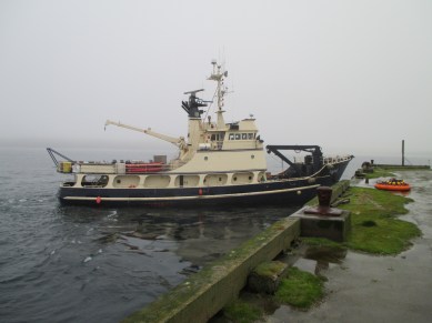
The Tiglax, the U.S. Fish and Wildlife research vessel, is contracted for the duration of our work on Amchitka Island. However, we have no weather delays, and our long days allow us to finish our field work about a day ahead of schedule. This affords the boat’s crew the opportunity for a short break before they pick up the next scientific team. After loading the ATVs and other gear onto the boat from the dock, the Tiglax heads back to Adak Island.

Me and Danika
Me, Danika Marshall, and the Aleutian Weather

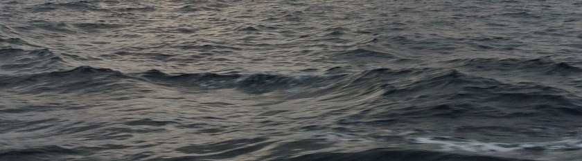
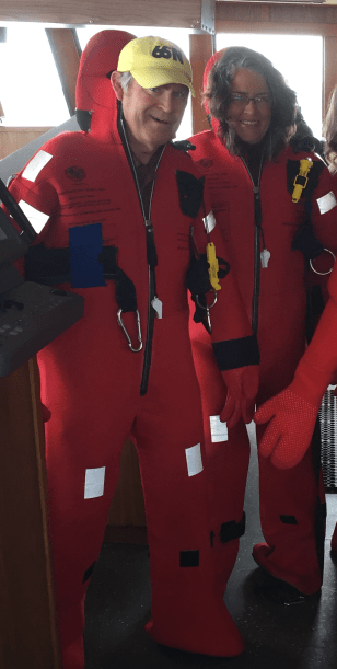
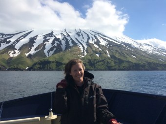
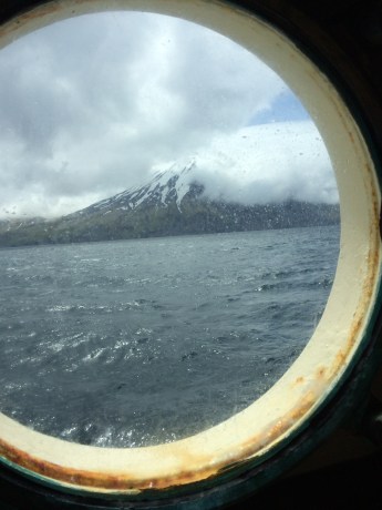
At first, all is well. I had applied a scopolamine patch to prevent motion sickness early in the day. It was doing its job admirably, as it had on the voyage out to the island days before. As the boat comes out of Constantine Harbor into a growing storm, those with more sense have already retreated to their bunks, but I go up to the wheelhouse to chat with soon-to-be-captain John Faris (Captain Billy Pepper will retire at the end of 2016) and enjoy the ocean views. At first, the waves are about 6 feet (2 meters) high, and they are all coming at the boat from roughly the same direction. So far, so good. As the Tiglax approaches Amchitka Pass, the swells grow, and they begin to pitch the boat in random directions – front to back, side to side, and everything in between. It is not a huge storm, but it’s big enough for me.

Motion is greatest at the top of the boat. With no warning, the boat lurches, and I am hit in the stomach with a surge of nausea. I stagger down two flights of steep nautical stairs, grip the handrails in the narrow hallways, and make my way back to my bunk in Stateroom #4. After lying down, I feel better pretty quickly. The scopolamine is valiantly doing its job holding the nausea at bay, but it doesn’t give me any good sense. As soon as I feel well, I head to the galley for dinner. It’s not a smart plan.

After storm
Adak Island after the storm

As the night wears on, the waves grow, and we all run a real risk of being pitched out of our bunks onto the floor. That never happens, but I roll from side to side like a bottle in my bunk for most of the night. It is quite a challenge climbing down from the upper bunk and finding my way along the hall to the bathroom, all the while being slammed into walls from various directions. At this point, I am questioning my desire to ever climb aboard a boat again, but by morning, my seasickness is gone. We approach the port of Adak under clearing skies and calmer waters, though I doubt any of us got much sleep. While most of the team stay in their beds, I enjoy breakfast and coffee with Craig Goodknight, who was the only passenger to experience no seasickness at all during the voyage.

Mt Moffett
Mt. Moffett comes out of the clouds on Adak Island

The team spends the night at the Fish and Wildlife Service bunkhouse in Adak. Fish and Wildlife employees do a lot of research in remote locations, and some wildlife refuges maintain bunkhouses for them. Earlier in the summer, we had all stayed at a bunkhouse at Brown’s Park National Wildlife Refuge in northern Colorado while we took our required ATV training course. But the house on Adak is a little different. Because it is so remote, guests  bring food with them, but they don’t tend to bring it back out. The kitchen cupboards are filled with all sorts of canned and boxed food, and there seems to be a historical collection of noodles. There is no way of knowing how long various items have been there, so I suspect that the foodstuffs accumulate faster than they disappear.

Rat traps
Trust me, rat traps are a good thing

One thing is for certain … the pasta collection gets no visitors who are rats. Fish and Wildlife takes rat control very seriously on the Aleutian Islands. Historically, seafaring vessels brought invasive rats to nearly all of the islands, and where there are rats, there are fewer nesting birds and other desirable, native species. Fish and Wildlife has worked hard over the years to  eradicate rats from as many islands as possible, restoring valuable native ecosystems in the process. While I chuckle at the rather obvious rat trap arranged between the refrigerators at the bunkhouse, I appreciate that it’s there.

Bald eagles
Eagles perched on Adak’s beach rocks

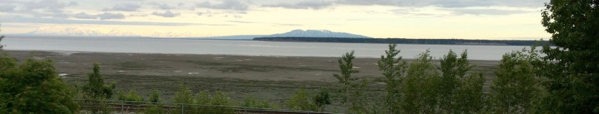
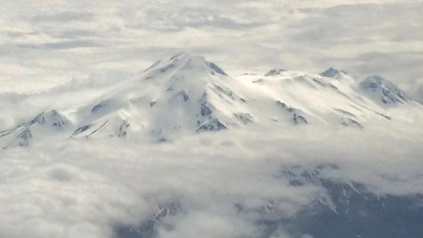
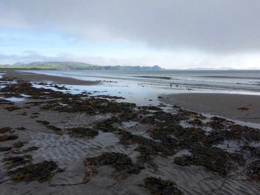
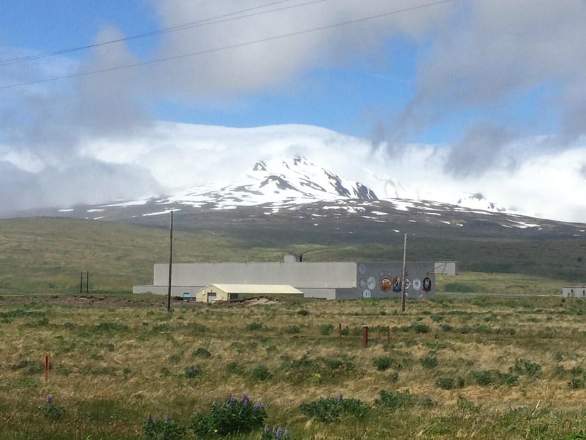
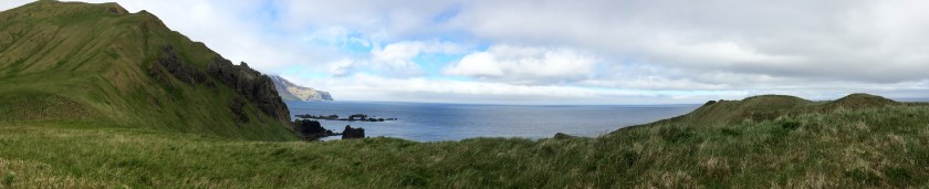
During our short stay at the bunkhouse, Danika, Craig, and I take the opportunity to walk the length of one of Adak’s beautiful beaches. There we see plenty of life, including a pair of bald eagles who are not particularly wary of us. Patches of blue sky appear overhead from time to time, revealing the slopes of Mt. Moffett and even the top of the more distant Great Sitkin, hovering like a disembodied head over a layer of  misty clouds.

We board the flight to Anchorage late in the morning but find that the flight from Anchorage to Denver has been delayed.

Disembodied head
The peak of Great Sitkin


We have all been up for a long time when we finally make our connection to Grand Junction. It will take some days for me to feel normal again.

On my first day back in the office, a co-worker who was a member of one of the monitoring teams in 2011 asked me if I was having trouble “reintegrating.”

This was a perfect description. Until that moment, I hadn’t realized it. I’d been vaguely troubled, distracted, and mildly ill since I’d returned. Some of my discomfort was residual dizziness from the scopolamine patches, and some was general haziness from jet lag, which I seem to be prone to, especially when traveling from west to east. But some of it was actually reintegrating.  It wasn’t easy to transition from such a strange, remote wilderness back into my  familiar, everyday life. Evidently, it happens to a lot of people who have made this journey. The Aleutian Islands are a beautiful, haunting place. I still feel their pull, like a mysterious gravity, a quiet tide.

Hulten
A marsh marigold (Caltha palustris) resting on Hulten’s flora of Alaska. During my adventures, I spent late nights in the stateroom aboard the Tiglax identifying the plants I’d seen on Amchitka Island. This image is a fitting ending to the story of my adventures there.

The Abandoned North: Part VIII – Amchitka Island: Natural Beauty on a Small Scale

Shoreline
Amchitka Island shoreline

Some of the first things I notice when I arrive at Amchitka Island are all of the coral-reef colors of anemones, sea stars, fish, and kelp that can be seen below the dock in Constantine Harbor. It reminds me that the Bering Sea is a richly diverse place in spite of harsh conditions on the  surface.

Nootka lupine
Nootka lupine

There is a lot of natural beauty here, but it isn’t like the stark, volcanic mountains, waterfalls, or wild ocean spray of many of its neighbors. This part of the island is quite flat, although there are small mountains in the distant wilderness area that I can’t glimpse through the heavy clouds.

Board
A tiny ecosystem on an old sawn board, with an urchin shell ornament


Amchitka’s beauty is on a smaller scale: flowers, lichens, mosses, birds, and urchin shells. Whole communities of mosses and other tiny life forms are even developing on the tarmac. On the island’s soils, in low areas that have been undisturbed for at least a few decades, thick pillows of peat have formed, with their own complement of plant life.

At higher altitudes, the ecology becomes more complicated. In these exposed areas, winds dry out the soils and plants, creating bands of miniature shrub communities built around crowberry plants that alternate with with bands dominated by tundra grass. Neither is considered to be a climax community by ecologists because the bands shift over time, a constantly morphing patchwork of slow-growing life. Different still are the verdant ecosystems near the ocean. There is huge diversity here, if you stoop down and look closely enough.

Runway
Bryophyte communities growing on Amchitka’s abandoned runways
Mooring
Plants along the shoreline near a rusty battleship mooring

One of my favorite experiences on Amchitka Island was witnessing flocks of Aleutian Canada Geese. They look like miniature replicas of the large flocks I see migrating in Colorado, complete with their striking black and white heads. But these have white collar feathers, and their honks are higher pitched. Every time I hear them, it makes me smile. Aleutian Canada Geese were listed as endangered in 1967 but upgraded to threatened in 1991. They recovered enough to be delisted in 2001. In the early 20th century, trappers brought nonnative foxes to the Aleutian Islands to expand the fur trade. These foxes decimated the nesting grounds of the geese. Lots of people worked to remove the foxes from the islands and relocated populations of the birds. These included efforts on Amchitka Island, where the geese were once extinct.

The human footprint since the 20th century on the Aleutian Islands is heavy and undeniable. But, here as everywhere, nature eventually creeps back into the works of human beings. My trip to Amchitka Island has reaffirmed for me the need to continue to attend to the remote places, the need to help them heal. Maybe they are the most important places of all.Chimney

The Abandoned North: Part VII – Amchitka Island: Military and Nuclear Devices

We have all enjoyed breakfast and dressed in waterproof, cold-weather gear before we arrive on the deck of the Tiglax. The crew has already used the boat’s crane to lift gear, including a bunch of all-terrain vehicles (ATVs) from the deck to the ancient military dock. The size of the dock is appropriate for battleships, […]

Rommel stake
World War II-era Rommel stake on Amchitka Island

We have all enjoyed breakfast and dressed in waterproof, cold-weather gear before we arrive on the deck of the Tiglax. The crew has already used the boat’s crane to lift gear, including a bunch of all-terrain vehicles (ATVs) from the deck to the ancient military dock. The size of the dock is appropriate for battleships, not for research vessels, and my question about how we’ll come ashore is answered right away as the crew attaches a nautical man lift to the end of the crane. Basically, we’re just a little more cargo to be unloaded. I prepare myself for my first trip in a man lift. It turns out to be fun.

Man lift
The man lift in operation

During World War II, when the island was used as a forward base in the campaigns to retake Attu and Kiska Islands, a road was built for access to various military facilities. The road runs the length of the 40-mile (64 km) long island and is called Infantry Road. In 2011, during  the previous Department of Energy monitoring trip, full-sized vehicles were used to access the monitoring sites. Since that time, earthquakes and storms have damaged the road, making it passable only by ATVs. To get to the farthest site, it is necessary for us to ride over 25 miles each way. The temperature is in the low 40s (4-5 °C), it is raining, and there is a brisk  wind. I feel like a popsicle by the time we arrive at “Drill Site E” to begin our monitoring.

Lunch
Me, Stephen Pitton, Craig Goodnight, and Danika Marshall eating lunch on Amchitka sheltered from the wind

The U.S. Fish and Wildlife  Service published a fact sheet that might help a reader get better acquainted with Amchitka Island. Most of the structures associated with World War II campaigns, Cold War nuclear detonations, and  Relocatable Over-The-Horizon Radar (ROTHR) facilities were removed during cleanup in the late 1990s. What is left is a treeless tundra, filled with the austere beauty of lakes, bogs, and mist. Much of the mountainous northeast end of the island, beyond Drill Site E, is designated wilderness. The remainder of the island is part of the wildlife refuge.

Paul
Team leader Paul Darr on the Amchitka tundra

That said, plenty of evidence remains of the military and other federal operations that once took place here. The lines of disturbance can plainly be seen on satellite photos. Some  structures remain, including a toppled officer’s club, an aircraft graveyard, a 2-mile-long (3.2 km) runway, and thousands of Rommel stakes poking up through the blankets of peat. Rommel stakes were used during World War II to make up wickedly simple defense lines. They are made of sturdy, rounded bars of iron, and the top is sharpened to a point. Loops were made in  the long, iron stakes themselves, and the loops were used to string lines of razor wire. Stakes like these are still being removed on more populated Aleutian islands, but they are visible across the landscape of Amchitka.

Left: The disintegrating wing of a World War II aircraft graveyard near Constantine Harbor. Right: The remains of an officer’s club from the 1940s. This building stood intact until only a couple of years ago. Now, only the chimney still stands. The island is slowly leaning back towards wilderness.

Long Shot
Monument describing the Long Shot detonation

It is hard to imagine how much effort went into planning and executing the three underground nuclear detonations on this island. The first was called Project Long Shot, conducted by the U.S. Department of Defense in 1965. The second, Project Milrow, was ordered by the U.S. Atomic Energy Commission in 1969 under chairman Glenn T. Seaborg, after whom the radioactive element, seaborgium, was named. In 1971, AEC concluded its underground nuclear tests with the largest in history, Project Cannikin. All of the detonations required weeks to months of drilling time and the construction of temporary villages to house the engineers, scientists, and workers.

Cannikin, the largest and deepest, needed a bore hole about  7.5 ft (2.3 m) in diameter and 6,150 ft (1,875m) deep, although the concrete plug at the top of the borehole is about 30 ft (9 m) wide. It feels strange standing above the sites, wondering what the eerie detonation chambers far below are like. Nobody really knows, but the detonations were expressed on  the surface, most notably at Cannikin. It is interesting to note that the international environmental activist group, Greenpeace, got its start protesting the Cannikin detonation. The fishing boat they used to voyage to Amchitka was named the Greenpeace.

Cannikin lake
This lake formed only after the detonation of the Cannikin device

Our work on the island is close to the detonation sites, so we visit all three. For those that are interested, film of these and other events has been declassified and is available on YouTube (Long Shot, Milrow, and Cannikin).

The Abandoned North: Part VI – Arctic Seas

Kanaga
Kanaga Island from the Tiglax

My time on Adak Island comes to an end with the arrival of the Motor Vessel (M/V) Tiglax (also known as the Research Vessel [R/V] Tiglax). The Tiglax (pronounced Tec-lah, meaning “eagle” in Unangam Tunuu) is a boat used for U.S. Fish and Wildlife Service scientific research. It serves the Alaska Maritime National Wildlife Refuge, which contains many of the Aleutian Islands. This summer, as in the past, Fish and Wildlife has kindly provided passage to Department of Energy contractors for our Amchitka Island scientific monitoring.

Tiglax
The Tiglax from the dock in Constantine Harbor, Amchitka Island

The 120-foot Tiglax was built in 1987 for Fish and Wildlife and has been working hard ever since. The captain, Billy Pepper, and five other crew members work hard as well. In fact, I can’t recall a time aboard the boat when I don’t see the cook at work. She conjures up handmade dishes like pesto-and-blue-cheese-stuffed pork roast, seafood linguine, and  blueberry pastries, all on a tight government budget, in a tiny galley, and with very little waste. I am an avid home cook and foodie, and I am impressed by her efforts in this remote place to keep both crew and passengers happy and well fed.

Flotation suits
Craig Goodnight and me in flotation suits during the muster drill

Anyone who has taken a cruise aboard a ship will be familiar with the muster drill. Similar to the health and safety briefing given before all of the government contract work I have ever done, it familiarizes the passengers with the boat’s emergency procedures. In this case, it consists of what to do if there is trouble on the  Tiglax and we have to abandon ship. The vessel is well maintained, and the crew is highly experienced, but I can’t help but think, as I try on an insulated survival suit that will keep me alive and afloat should the unthinkable happen, “This is the friggin’ Bering Sea!”

The weather is beautiful, and the sea is calm as we depart for Amchitka Island. The Tiglax will be our home during the voyage and also while we are working on the island. We share the boat with several other teams who also have work there. One is from Fish and Wildlife, who have work characterizing one of the few old structures standing on the island.

Dani on Tiglax
Danika Marshall on top of the Tiglax

The other is from the U.S. Geological Survey, who need to do maintenance on seismic monitoring equipment. Our voyage will take about a day. I spend most of the daylight hours outside, drinking in spectacular views from a perch with some of the other passengers on the top of the boat. Much of the night is spent crossing Amchitka Pass, a patch of open ocean where the waves grow large. I am jolted around in my bunk but manage to get a decent night’s sleep anyway. The first mate, John Faris, has spent the night at the helm, as he does every night during the field season. My experience on the Tiglax gives me even more respect for people who make their living on the Bering Sea. I’m not sure it’s a life I could thrive on.

Left: The corridor outside State Room No. 4 on the Tiglax. Right: I choose the top bunk

Porthole
The view from the port hole by my bunk as we voyage to Amchitka Island

A peek outside the still vessel before coffee and breakfast reveals glassy waters and a massive, old military dock in Constantine Harbor, Amchitka Island. We have arrived safe and sound. I am ready and anxious to get to work. Now I just need to know how we’re going to get ashore. The smaller docks are in shambles, and the shoreline doesn’t look gentle with its dark volcanic rocks. The tide is out, and that ancient dock is towering above the top deck of the boat. Soon, we will find out.

Dock in morning

Early morning in Constantine Harbor

The Abandoned North, Part V – Flora and Fauna

Buttercups, stonecrop, and wild daisies

Empetrum nigrum (crowberry)
Crowberry

Aleutian plants are generally small, unlike the monster-sized devil’s club and thimbleberries that festoon Alaska’s Inside Passage. The Aleutian Islands are at latitudes mostly south of the Inside Passage, so they should be warmer, and the plants should be larger, right? But they’re not. Both parts of Alaska have a maritime ecology, but the Aleutian Islands are far more exposed, mostly to wind but also to constant cold. Although they have no permafrost, they are covered in tundra, so there are a lot of peat bogs and dwarf plant communities. The islands have what ecologists might term “low energy systems.” But there is nothing low energy  about the abundance of flowers that are now blooming on Adak Island. Each time I see a new species, I figure out what it is and fall in love with it.


img_1320
Arctic willow

There are many species in common between Adak and Amchitka Islands, so getting acquainted with the local wildflowers will help  me with my botanical work on Amchitka. Back home in Colorado, I am somewhat notorious for interrupting hikes in favor of “botanizing.” Things are no different here in Alaska! My botanizing adventures result in a lot of notes and photographs, and among my favorites are those of the the  full grown arctic willows. They are elegant, twisted little dwarfs, decades old but only inches tall.

Along numerous trails on Adak Island, the crowberry is in bloom. I have always wanted to see crowberry, as it’s mentioned in what is still my favorite television program, Northern Exposure. There will be no berries on these plants for months yet, so I can’t try one,  but  there is an abundance of other wild foods on Adak Island in the early summer.

img_1045
Hiking across the tundra on the way to Lake Betty

On a hike to Lake Betty, we find fiddleheads, which are the curled, emerging leaves of the ostrich fern. Craig, Danika, and I nibble a few raw, then I pick a small handful to cook later. They are marvelous, much like the variety of fiddlehead I grew up with in Maine. I also know that all violet flowers are edible, so I nibble on a couple of those as well. They are mild and sweet, and a tiny bit flowery. I wish I could meet a member of the Unangan people who would be willing to show me what else I might be able to sample.

img_1051
Craig and me nibbling on fiddleheads

Edible plants are not the only reason I would love to  become acquainted with the  Unangan. Their ancestors are believed to have lived on these islands for at least the last 2,000 but possibly up to 9,000 years. The Aleutian Islands, and the wild seas that surround them, are among the most formidable places on earth. I have a lot of respect for people who have lived here for so  long and who continue to  persist in spite of the adversity and atrocities brought to their home since long before the 1940s. They are certainly among the hardiest and most capable of people, with a history and culture that I would love to know more about.

img_1481
A chiton

Among the biota samples collected for monitoring by the first Amchitka team last month are the traditional Unangan foods of reindeer moss, chitons, and Dolly Varden. Reindeer moss is a type  of gray-white lichen, which I am reluctant to taste raw but don’t know how to cook. Chitons are dark, prehistoric-looking sea creatures. I find one on the beach and pick it up, only to have it curl up slowly on my glove like a pillbug. Obviously it’s still alive, so I toss it back into the sea, wondering what something like Eagle on Adakthat could possibly taste like. Dolly Varden is a native species of trout. I dined on a lot of trout as a young person in Colorado and usually feel like I’ve had enough of it, but Craig, who wielded a  fishing-license, caught an extra (the others went into a sample bag as background samples for the monitoring). It was a delicious, firm fish that I would gladly eat again.

One of the most astounding things about the Aleutian Islands is the diversity of wild things. Bird life is abundant, especially eagles, gulls, cormorants, and a variety of shorebirds. It is here that I see my first puffins, the Arctic answer to penguins, although puffins fly relatively well, unlike their southern hemisphere counterparts. They have cute, stout bodies and heavy,  colorful beaks, both of which give the impression that their wings can barely keep them aloft.

Pack of sea otters in Clam Lagoon
Sea otters in Clam Lagoon

A cruise around Adak Island’s Clam Lagoon is a treat. We see groups of Northern sea otters, flocks of sea birds and shorebirds, harbor seals, and bald eagles. On the beaches around the lagoon are thousands of Pacific razor clam shells. On other beaches around the island, I find the shells of butter clams, mussels, sand dollars, and plenty of barnacles along with washed-up kelp and enormous amber-striped jellyfish. People don’t always think of the North as an abundant place, but the Aleutian Islands are rich with life everywhere I go.

Barnacles and friends on the left, a huge jelly washed up on the beach on the right

The Abandoned North, Part IV – Adak Island: Unexploded Ordnance


img_1340
Craig Goodnight at the top of a porphyry dome, Adak

Unexploded ordnance: these are two words I encounter often during my visit to the Aleutians. Called UXO for short, it comes in many forms – bombs, artillery shells, bullets, torpedoes. In the Aleutian Islands, it also comes from many

img_1484-1
A warning poster aimed at children to avoid UXO, featuring Boomer the Otter

places – ordnance left by the United States during World War II to defend against Japanese attacks, ordnance left by the Japanese to defend against U.S. attacks, ordnance used for weapons testing during the Cold War, ordnance launched but unexploded, and ordnance intentionally buried, or maybe even stored and forgotten. Large tracts of land on the northern  part of Adak Island are still being cleared of UXO, and we’re told that it’s possible to find it in unexpected places outside of this area. Warnings are everywhere, most prominently warnings for children. UXO even has its own mascot, a helmet-wearing Boomer  the Otter.

img_1366
Warning signs along the perimeter of an area where UXO is still being cleaned up

Unexploded ordnance is not the only danger to people of Adak Island. There are also a lot of abandoned buildings with hazards like disintegrating materials and broken glass. Some date back as far as 1942, when the U.S. Army first arrived. At the peak of the World War II Aleutian military campaigns, Adak Island was home to 30,000 people. There were probably between 6,000 and 7,000 residents living here later, during the Cold War, maybe more. According to the 2010 U.S. census, it is now home to 326 people, although the year-round population is said to be closer to 100.

Humanity’s ruined structures hold a particular fascination for me, as they do for many others, and, like skeletons, they only become more fascinating as they age. Don’t ancient Egyptian tombs hold more intrigue than homicide scenes? For this reason, I find the older quonset huts more compelling than the newer barracks, the older Bering Chapel more beautiful than its newer replacement.

Two World War II era quonset huts built in the 1940s. According to a historical guide published by the City of Adak,  the structure on the right was part of an early hospital facility.

Left: The historic Bering Chapel, built in 1944 by the U.S. Army Corps of Engineers, with newer windowless, abandoned dormitories in the background. Right: The now abandoned Bering Hill Chapel that replaced the older structure in the 1980s.

Left: View of an abandoned neighborhood in Adak. Some of the condominiums are missing walls, probably from Arctic hurricanes. Center: More abandoned condominiums, with snow-capped mountains emerging from the clouds. Right: A derelict vacuum cleaner, complete with its cord, outside one of the empty military facilities on the island.

img_1485
Unexploded ordnance is on the menu at Bay 5

As I expected, my favorite thing about Adak Island turns out to be the natural world, but before I get to that (in Part V), there is one more piece of UXO to mention: the Unexploded Ordnance at Bay 5. A fellow named Bernardo Diaz is the proprietor of Bay 5, Adak’s Mexican American restaurant. The establishment offers a unique dessert that consists of a deep-fried Snicker’s bar topped with cinnamon-sugar, chocolate, and whipped topping. It’s tempting, but I decide not to buy one, as I am already full from delicious chicken enchiladas swimming in unpredictably fresh and authentic red chile. Surprises from remote Alaska never cease.

The Abandoned North, Part III – Adak Island: Birthplace of the Winds

img_1347
Horseshoe Cove on Adak Island

When I was in high school in Denver, Colorado in the late 1970s, we were all trained to fear the Soviet Union and to worry about potential nuclear warfare. At that time, I’d never heard of Adak Island, although it was an important military base. Activities on the Adak Naval Air Station were not advertised during the Cold War. It wasn’t easy for civilians to visit, and other facilities such as Shemya Air Force Base, west of Amchitka, were completely top secret. The base on Adak closed in 1997, and officials chose the least expensive option to disposition the facilities: abandonment. Most of the buildings are now empty, their shattered windows and tumbled walls open to the wind and rain.

We land at Adak Airport, on a runway that I later learn has been in continuous use since the end of World War II. As we descend the aircraft stairs, we are greeted by a large sign reading, “Welcome to N.A.F. Adak, Alaska, Birthplace of the winds.” Inside, a small crowd is forming to await the delivery of our bags. There is an old map of the city on one wall, a diorama of shorebirds on another, and a video on a high-mounted television warning about unexploded ordnance. Nobody is paying any attention.

Adak Airport sign
This is the sign that greets us as we step off the jet and into the Adak airport. Unangan call the island the Birthplace of the Winds, although the name “Adak” comes from the word “Adaq,” which means “Father.”

The City of Adak came into being in 2001, and it is composed mainly of repurposed military housing units, some of which may be rented by visitors. One of the rental companies is Little Michael Lodges, chosen by our team because the condominiums have wifi, as not all of the rentals do. Little lines of caribou skulls are posted like troops along the front of the homes, left by past hunters. Some of the skulls sport green antlers and little topknots of moss. Inside, a bottle of wine and a plate of chocolates welcome us into the kitchen.

It is expensive to bring materials to Adak, so the rentals are not quite like cabin rentals elsewhere. Visitors need to be flexible. There is not a full complement of cooking implements in our condo, so we improvise, and I discover that a wire whisk is actually one of the best ways to mash potatoes. There is plenty of bedding, but the bedroom curtains are thin, so I hang some of the sheets over the windows to block the long daylight that interferes with my sleep. The most inconvenient adjustment is the cold water in the showers upstairs, but otherwise the condo is cozy, clean, and comfortable. None of this is a real cause to complain. After all, I didn’t expect to be pampered in remote Alaska, at the edge of the Bering Sea.The Adak National Forest in its entirety

“Birthplace of the Winds” is a perfect name for Adak Island. Early on my first morning there, I go for a run along the beach with our team geologist, Craig. The temperature is well above freezing, but the wind cuts through me, bracing and invigorating! There are frequently hurricane-force winds here. Although we don’t experience any of these, there is barely a minute during our visit when there isn’t a strong wind blowing. It is so often cold and windy on the Aleutian Islands that trees can’t persist. Many decades ago, servicemen planted small groves of conifers on Adak Island as a morale boosting exercise. One of these stunted groves is famously known as “Adak National Forest,” the entirety of which can still be hiked in less than a minute.

We continue to tour the town. There are one or two small stores, several restaurants,  and warehouses operated by the Aleut Corporation, which owns moSunken Navy tugboat at Adak
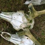
st of the northern part of the island, and the U.S. Fish and Wildlife Service, which manages the wildlife refuge in the south. There are also a whole lot of empty buildings and a collection of docks in Sweeper Cove, Adak’s harbor. Some are in use, while others are decaying. There is a sunken tugboat in one corner, still tied to shore. It is the Mecosta, built in the early 70’s and sold by the Navy in the early 2000s. A second tug, the Redwing, also once served in the harbor and lies underwater nearby. Something about the repose of the well-crafted boat is picturesque, maybe even beautiful.


The Abandoned North, Part II – Anchorage: Midnight Sun

View from Elderberry Park in Anchorage
Mt. Susitna, “The Sleeping Lady,” and Cook Inlet from Elderberry Park, Anchorage

The last time I saw Cook Inlet was in early March, 2012 as my husband and I left Anchorage on the way back from the Alaska interior and the ceremonial start of the Iditarod sled dog race. At that time, the inlet was filled with a flotilla of ice chunks, their edges worn round, dim in the twilight beneath the plane. This summer, the water of the inlet is calm and clear, topped with blankets of low-lying clouds and surrounded by a land shaded green. Plant life abounds in the city as it basks in over 19 hours of daylight. At 61 degrees north latitude, this is the land of the midnight sun.

Rainbow in Anchorage
View from Room 1229 of the Anchorage Marriott Downtown hotel. A bright rainbow over Delaney Park makes it look like midday, but this photo was taken after 11:00 p.m. on June 11

On our previous trip, a former Anchorage resident recommended the Rusty Harpoon to my husband, and I love this shop enough to return in 2016 with my friend and fellow ecologist, Danika Marshall. I buy some Alaskan malachite/azurite jewelry and ask the owners, Bill and Sheri, about a good place to eat dinner. They send us to the F Street Station with a warning that it will be crowded. They are right about that, but as soon as we arrive, five people miraculously evacuate a table by the front window, and we claim it for the Amchitka team. Along with Danika and I are team leader Paul Darr, geologist Craig Goodknight, and engineer Stephen Pitton. The men have all been to Amchitka many times, and I value their knowledge and experience.

Craig Goodknight, Paul Darr, Stephen Pitton, Danika Marshall in F Street Grill in Anchorage
Craig, Paul, Stephen, and Danika at the F Street Station.

F Street serves local and regional beer on tap in pint-sized mason jars. I opt for a Dolly Varden Nut Brown from Kassik’s Brewery in Kenai and order a sourdough crab roll and some Alaskan oysters on the half shell – all good choices. While waiting for food, customers can help themselves to slices of Tillamook sharp cheddar cheese, cut from a huge block placed out on the bar. In what must be an example of Alaskan humor, the cheese block comes with a  warning:

Display Only: Do Not Eat

But there is a cheese slicer sitting  invitingly on top.

The long daylight must be affecting me because I don’t get much sleep, although my room at the Anchorage Marriott Downtown is comfortable and nice. In the hotel lobby, they serve Kaladi Brothers Coffee, an Alaskan brew of a different sort. I buy a cup. I have to confess that I am a coffee snob and only enjoy fresh brews made from Coffea arabica beans. Kaladi Brothers doesn’t disappoint. Strong, black coffee in hand, I take a little walk at dawn to nearby Elderberry Park, where I stroll past jewel-bright gardens and wildflowers. There are exotic-looking mudflats along Cook Inlet and snowy mountains in the distance, including Mt. Susitna, also called “The Sleeping Lady.”

Paul recommends breakfast at the Snow City Cafe, so the team meets there. My “crabby omelette” is well worth the wait. The food is fresh and the service is excellent, but like most American breakfast places, the coffee is made with Coffea robusta beans, so I don’t drink too much. The team has a tight schedule, as we need to buy groceries for our stay on Adak Island and drop them off at Alaska Air Cargo in time for the flight later in the day. We also need some last-minute supplies for our work on Amchitka Island.

Alaska Air Cargo dock
Alaska Airlines runs passenger and cargo service to Adak Island. I love Alaska Air. They still value customer service, unlike many larger airlines. On the flight, they serve tasty, warm food and give us excellent care. We are also allowed 3 free checked bags on the flight.

In midafternoon, we board the jet for the 1,200 mile (1,930 km) flight to Adak Island, where flights end and further travel must be by boat. Alaska Airlines is the only passenger air service to the island, running two flights per week. The passenger cabin is only about 20 percent full, but the cargo bay must surely be near capacity. Reeve Aleutian Airways once ran frequent flights to and from many of the islands, but it shut down in 2000, only three years after the closure of the Navy base on Adak Island.

Raven sculptures in Anchorage airport
Raven sculptures at Ted Stevens International Airport in Anchorage. Ravens are my favorite birds, tricksters of legend. I’m hoping they don’t have too many tricks planned for us!

I’ve been doing some research on the area and am anxious to see what I can of the mountains and coastlines from the plane window. Hopefully, clouds won’t obscure everything. On March 27, 2016, the Pavlof Volcano erupted on the Alaska Peninsula about halfway between Anchorage and Adak. It spewed a fountain of brilliant red lava and created lightning, both visible from the village of Cold Bay. There were some minor explosions and ash fall in mid May, but the volcano was quiet again by June. I watch for the mountain as we fly above and can see a symmetrical white peak in the space between a carpet of clouds. It is likely Pavlof, or maybe it’s an adjacent cone called Pavlof Sister. Either way, it is a stereotypically perfect cone-shaped volcano.

Pavlof Mountain, active volcano
Pavlof Volcano – or maybe it’s Pavlof Sister – from the window of the Alaska Air jet

The Pribilof Islands, far north of the Aleutian chain, were once part of the Bering Sea land bridge. Woolly mammoths foraged long ago on meadows that are now sea floor. According to recent scientific discoveries, the Pribilof Islands were one of the last refuges of the woolly mammoth after the Ice Age. While mammoths went extinct on the North American mainland between 13,000 and 14,000 years ago, they persisted on St. Paul Island until about 5,500 to 5,700 years ago. It seems an unlikely place for huge animals to live, as there are few large mammals up there now. I wonder if any of the Aleutian Islands are hiding fossils too, and what unexpected surprises they might hold. I look out the window of the plane. Through choppy sea-clouds that resemble cave popcorn, I glimpse a wild coastline. It must be at least 20 miles long, with no houses, no buildings, no roads. It tugs at my heart, and it seems like anything is possible down there.

The Abandoned North, Part I – Bound for the Aleutians

aleutian-islands
The Aleutian Islands

The Aleutian Islands are a vast, volcanic archipelago that runs west from the Alaska Peninsula towards the mainland of Russia. On a map, the islands are draped like necklace beads between the Bering Sea and the North Pacific Ocean. People don’t crowd to get to the Aleutians, at least not anymore, since most of the United States military installations there were abandoned after the Cold War. Many born-and-bred Alaskans have never set foot on an Aleutian Island.

It is June, 2016. The desert heat in my home town of Grand Junction, Colorado, is already building, but I am loading bags full of cold-weather gear to board a plane bound for Anchorage. Our final destination is the uninhabited island of Amchitka, one of the Rat Islands in the western part of the Aleutian Chain. The site of three underground nuclear detonations, it is distant, cold, and off-limits without a special permit. It is by far the most remote place I can ever hope to visit.

Sitkin Peak above the clouds
One of the Andreanof Islands in the Aleutian Chain is Great Sitkin Island, dominated by the Great Sitkin Volcano. It is an active stratovolcano with a caldera and dome, last erupting with an explosion and a pale plume in 1974. In July and August of 2013, two swarms of earthquakes were reported at Great Sitkin. All is quiet in 2016 as our airplane glides by.

Every five years, scientific teams are sent to Amchitka Island to perform environmental monitoring for the U.S. Department of Energy, the long-term steward of the detonation sites. I am an ecologist by trade, a botanist by education, and I am fortunate to be chosen as a member of one of the teams. My job will be to measure and record the vegetation growing on landfill covers. Plants are an essential part of the cover design. The landfills contain hazardous wastes that were generated from drilling the holes for the underground detonations. The radioactive materials from the detonations themselves are entombed deep underground – none have ever been detected on the surface, in the ocean, or in the ecosystem. The once-classified detonations are now public record, and you can read about Amchitka Island on the Department of Energy Office of Legacy Management’s website. This blog in no way speaks for the Department of Energy or any of its contractors – this is simply an account of my personal adventure.

Left: The greening slopes of a volcano in the Andreanof Islands.
Right: Meltwater plunges down the black cliffs towards the sea

It will turn from spring to summer in the Aleutians, as we will spend the Summer Solstice there. If there is a warm spell up north, the temperature may top out at 50 degrees Fahrenheit (10 degrees Celsius). Chilly even in summer. The Aleutian Islands and the Bering Sea are not for the faint of heart. But my journey doesn’t begin with Amchitka Island. After a layover in Denver and a long flight, it begins with a night in Anchorage, the land of the midnight sun.

%d bloggers like this: